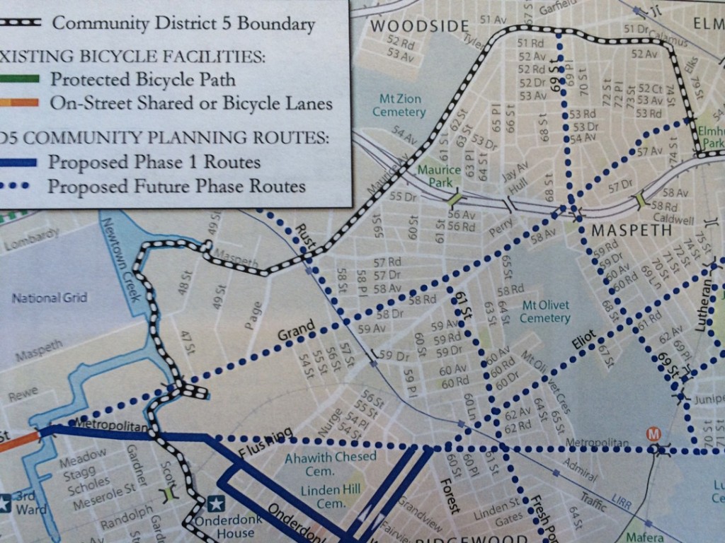
Citing safety and the growth of bicycle usage in the Maspeth community and throughout the city, the Department of City Planning has released a preliminary plan for both shared bike lanes and dedicated bike lanes for the Maspeth area. Representatives from DCP came to the Maspeth Industrial Association meeting to meet with owners in the Maspeth Industrial area last week to get input to the plans.
Although some parts of Community Board #5 area are slated for bike lanes by Fall of 2014, Grand Avenue, Metropolitan Avenue, Eliot Avenue, Maurice Avenue and 69th Street, which are all planned for bike lanes, would not be done until a second phase is implemented.
Dedicated bike lanes are only put into one-way streets if they are 30 feet wide or more, while two-way streets have to be 46 feet wide to get a dedicated bike lane – which means automobiles can not go into those lanes.
Sharrows, or Shared Bike Lanes are put in if streets are not wide enough for dedicated lanes, and according to Kristina Schmidt, from DCP, the shared lanes let motorists know that cyclists can be on this road.
These plans come nearly eight months after the Department of City Planning (DCP) and Department of Transportation (DOT) held a community workshop with bikers and residents at Maspeth High School back in May 2013, ‘Phase I’ plans and the potential for a future sprawling layout of dedicated bike lanes and shared paths were presented as completing lanes in Ridgewood and South Glendale by the Fall of 2014.
“This plan was recommend by the transportation committee of CB#5 as well,” said Schmitt, who is a highway transportation specialist with the DCP.
As initial plans called for bike infrastructure along Eliot Avenue in the first phase of development, expected to begin sometime this summer, it was later tabled for the second phase as some concerns arose with the narrow thoroughfare.
“It (Eliot Ave.) wasn’t taken out, but it isn’t a dark blue line,” she added, referring to the map outlining their updated plans. (Dark blue lines on the map represent Phase I of bike infrasturcture)
See map below:

